
A picture is worth a thousand words
There’s nothing worse than trying to work with a bunch of paper plans, all in different scales and impossible to overlay one on top of the other when you are trying to plan, let alone having to determine distances and volumes using a scale ruler and calculator.
We work with you to create above-ground and below-ground digital twins of your operation.
An above-ground model is generally based on a drone platform like Propeller, DroneDeploy or Strayos and contains all survey data, boundaries, pit and dump designs, services etc.
A below ground model is generally built on a web based geological platform and brings together drill holes data, block models, geological models and geotechnical data.
Once setup, stakeholders can find, view and overlay the data they require, downloading it as needed and ensuring a “single source of truth”, reducing both management time and potential error.
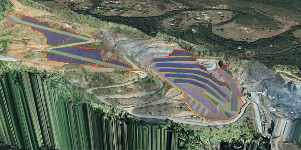
QUARRY DIGITAL TWIN
Examples of the type of information that can be included
- Pit designs
- Dump designs
- Thickness of overburden
- Extraction boundaries
- Drone flight plans
- Water catchment analysis
- Stormwater modelling
- Location of exploration drill holes
- Geological boundaries
- Material types by bench
- Services
- Cadastral boundaries